Metadata
The metadata of depositar are composed of dataset level metadata and resource level metadata.
Dataset Level
We have organized the metadata at the dataset level into three categories: Basic Information, Spatio-temporal Information, and Management Information.
Basic Information
| Field Name | Required | Description | Range |
|---|---|---|---|
| Title | No | It is recommended to make it brief but specific. E.g. “Taiwan population density by region” is better than “Population figures”. | Must be a valid unicode string. The value will be the same as the URL
field if the provided value is empty. |
| URL | Yes | This URL will be unique across CKAN. Only letters, numbers, - and _ characters are accepted. The URL will be generated automatically when you input the title of the dataset. If there is no letter or number in the title, a random hash will be generated. You can modify the generated URL afterwards. | Must not be empty. Must be a valid unicode string. There can not be a dataset with the given name already exists. The length limit for the URL is from 2 characters to 100 characters. |
| Description | No | You can add a longer description of the dataset here, including information such as where the data is from and any information that people will need to know when using the data. | Markdown |
| Data Type | Yes | The type of the dataset. Fields will be changed according to the data type. | Accept multiple values. Use the PARSE.Insight Content-types. |
| Wikidata Keywords | No | Search Wikidata items for keywords to describe the dataset as shown below [1]. For labels that are specific to your projects or datasets (eg. grant no.), use Tags instead. The language of keywords may align with the site language setting. | Accept multiple values. |
| Tags | No | Here you may add tags that will help people find the data and link it with other related data. Tags should be used as labels that are specific to your projects or datasets. | Accept multiple values. Must be a valid unicode string, -, _, or . characters. The length limit for the tag is from 1 characters to 100 characters. |
| Language | No | The language of the dataset (e.g., Chinese or Japanese). Main language (according to Wikipedia: World language) will be listed first, followed by other ISO 639-3 languages in alphabetical order. The translations for language names are taken from Debian’s iso-codes project. | Accept multiple values. Must be a language defined in ISO 639-3. |
| Remarks | No | You can put some supplementary information for the dataset here. | Markdown |
| [1] | 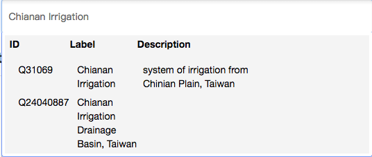
|
Spatio-temporal Information
| Field Name | Required | Description | Range |
|---|---|---|---|
| Temporal Resolution | No | Please refer to Fill-in snippet for temporal information. | Must be one of the following resolution: Yearly
Monthly
Daily
|
| Start Time | No | Same as above | Must be in one of the following format: YYYY
YYYY-MM
YYYY-MM-DD
|
| End Time | No | Same as above | Same as above |
| Spatial Coverage | No | Please refer to Fill-in snippet for spatial fields. | GeoJSON format |
| X.min | No | Same as above | Must be a float between -180 and 180, and X.max must be greater than X.min. |
| X.max | No | Same as above | Same as above |
| Y.min | No | Same as above | Must be a float between -90 and 90, and Y.max must be greater than Y.min. |
| Y.max | No | Same as above | Same as above |
| Spatial Resolution | No | Spatial resolution (in meter) of source. | Must be a positive float. |
Management Information
| Field Name | Required | Description | Range |
|---|---|---|---|
| License | Yes | Declare the license for the dataset so that people know how they can use the data. If you need to use a license not on the list, please select the “Other Licenses” and mark the license in the Remarks field above. |
Must be one of the following licenses: License Not Specified
Other Licenses
|
| Creator | Yes | The name of the person or project responsible for producing the data. | |
| Created Time | No | The time when the resources in the dataset were created. | Must be in one of the following format: YYYY
YYYY-MM
YYYY-MM-DD
|
| Process Step | No | Steps of data generating process. | Markdown |
| Project | No | If you are a member of any projects, this drop-down will enable you to choose which one should own the dataset. If you select “No project”, this dataset will not be owned by any project and will be opened to the public. If you check the “Open for project members only” box below this field [2], this dataset will only be seen by members of the project owning the dataset and will not show up in searches by other users. Otherwise, the dataset will be public and can be seen by any user of the site. | |
| Contact Person | No | The person responsible for maintaining the dataset. | |
| Contact Person Email | No | The email of the person responsible for maintaining the dataset. | Email format |
| [2] | 
|
Resource Level
| Field Name | Required | Description | Range |
|---|---|---|---|
| URL | No | The url of the resource. | Must be a valid unicode string. |
| Name | No | The title of the resource. | Must be a valid unicode string. |
| Description | No | You can add a longer description of the resource here. | Markdown |
| Character Encoding | No | The character encoding of the resource (e.g., UTF-8 or Big5). Applied only to shapefile resources for now. |
Big5
UTF-8
ISO-8859-1
GB2312
GB18030
Shift_JIS
EUC-JP
|
| Coordinate Systems | No | This field is required when the resource is in shapefile format with no projection (.prj file), otherwise the shapefile can not be previewed. The EPSG (European Petroleum Survey Group) system has been used. | Must be a postive integer. |
| Format | No | The file format of the resource (e.g., CSV, XLS, JSON, or PDF). The data preview function will check this field to specify a proper resource view. Please refer to Extended feature — Data preview and visualization. | Must be a valid unicode string. |